Not All Who Wander Are Lost

Not All Who Wander Are Lost
June, 2019 - Mount Denali, Alaska

Saturday, July 30, 2022

Bend, Redmond and Sisters, Oregon

We spent four days in this area staying at the Expo Center RV Park in Redmond. It was over 100 degrees each day, so we decided not to golf as originally planned. What to do instead. Visit microbreweries!!

This area is near the Cascades Mountains. Three of these mountains are called the Sisters, and are very prominent. Beautiful views from just about everywhere.


I like the barn in this picture, too.

Brews were sampled at three breweries in Bend. We actually stopped at five, but the Bend Brewing Company had a long wait time and the Silver Moon Brewery didn't have any brews that appealed to Kevin. He doesn't like IPAs, and that seems to be the prominent type of beers brewed in the Pacific Northwest. There was a very awesome mural at the Silver Moon Brewery, though. A tribute to musical artists that covered the side of an entire building.


I don't drink beer, but Kevin found some samples to try at Boneyard Brewery, Deschutes Brewery and Kobold Brewing. A few of the breweries had hard cider, so I was able to sample some of those.


They had the best chocolate peanut butter pie at this place!!

Kevin liked the Hazelnut Porter here.

The next day we checked out some breweries in Redmond, Oregon. There was also a Joann Fabrics in Redmond, so I was able to stock up on a few quilting items. The breweries were Initiative Brewery and Wild Ride Brewery. 

Kevin liked the Gemini Amber Ale and Russian Imperial Stout. He got some crowlers of each to take home.

They had a cool flight holder at Wild Ride. Kevin liked the Nut Crusher Peanut Butter Porter and got some bottles to go.

The next day we drove about 30 miles to Sisters, Oregon. It's a cute touristy town. They have a quilt shop that is quite popular among quilters. 


I found a few items I had to have. Also, I got this quilt pattern (the one on the right). I don't know where I'm going to put it when I finish it, but it spoke to me, so what could I do??


We stopped at the Three Creeks Brewery,  The nachos were delicious!


When we left Yuma on July, 5th it was over 100 degrees. Most of the time as we traveled through California and Oregon, it was just as hot. The only relief was the few days we spent in the national parks which were at higher elevations. As we left central Oregon and headed to the coast, we were looking forward to some cooler temperatures. The 200 miles drive was along some really beautiful wilderness area with so many pine forests. We saw lots of logging trucks.


Don’t wish upon a star – Reach for one!

Sunday, July 24, 2022

Crater Lake National Park

We left Redding, California heading north on I-5 to scenic Highway 97 heading to Diamond Lake, Oregon. Highway 97 is called the Volcanic Legacy Scenic Byway All American Road. The scenery was breathtaking. Lots of volcanos/mountains and pine trees. We went right past Mount Shasta with gorgeous views.


We arrived at Diamond Lake RV Park, about 15 miles north of Crater Lake.  There are not many campgrounds in the area, and it is very rustic. The campground had no TV signal, cell reception or wi-fi. It's amazing how accustomed we've become to our phone and internet. It's not a bad thing to disconnect. However, when in a vacation area, it would have been nice to be able to use our maps app and look up information. We managed!

Diamond Lake is beautiful with Mt. Bailey on one side.


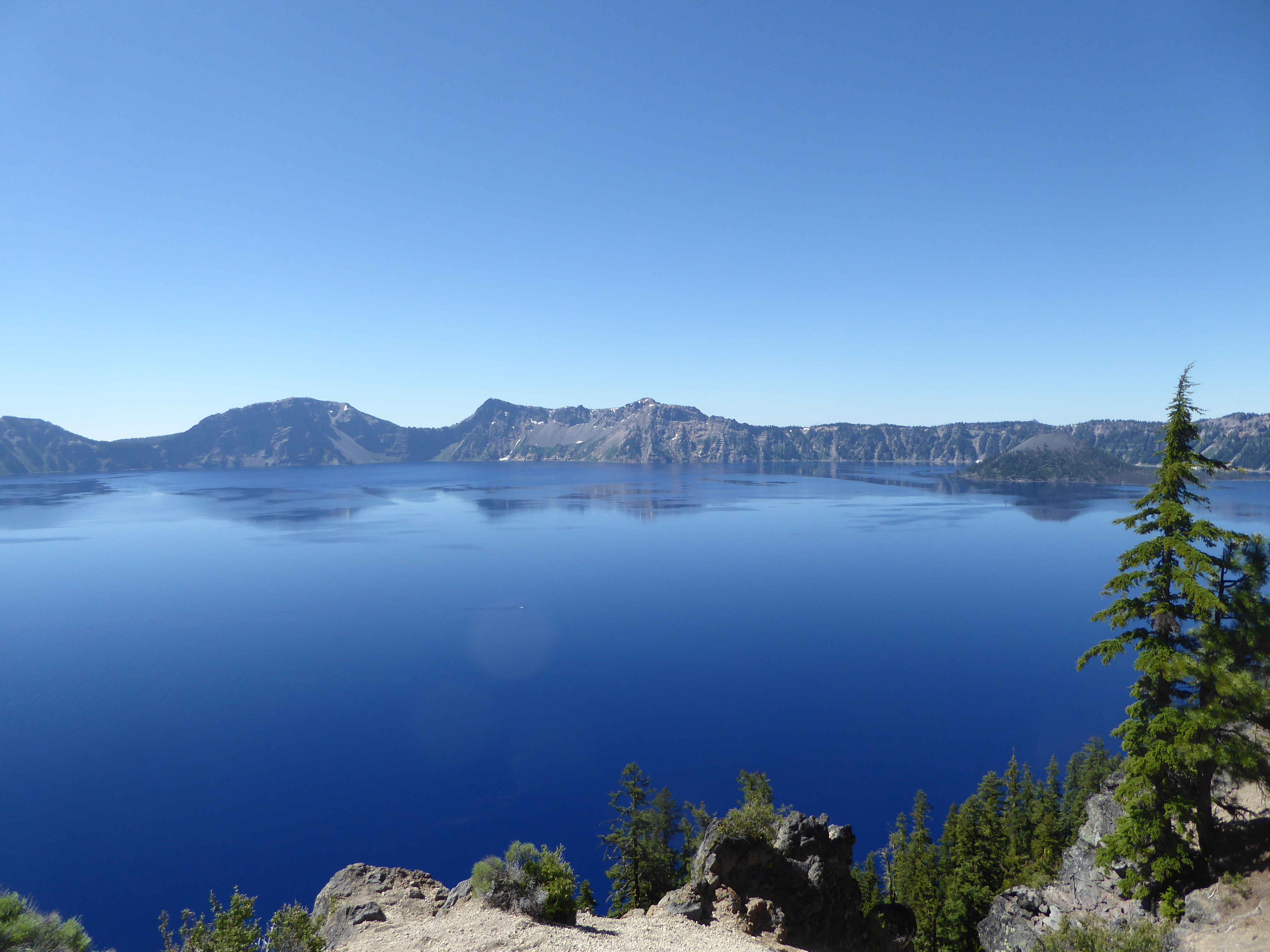
We spent one day driving along Highway 138 to view some waterfalls. The campground had given us a map with six falls. We visited four of them. The first was Clearwater Falls. It was close to the parking lot.


The second one was Whitehorse Falls, also close to the parking lot.


Third was Watson Falls. This one was about a one mile roundtrip, uphill all the way to the falls.


The last one was Toketee Falls. This was also over a mile roundtrip with lots of stairs.


The next day we headed to Crater Lake National Park, entering at the North entrance. Here's the first viewpoint we came to. The color of this lake is the deepest blue I've ever seen on a lake. According to a ranger, the reason is the depth reflecting back the deep blue color. The deepest part is 1,943 feet. If you put the Statue of Liberty on top of the Washington Monument on top of the Eiffel Tower, you would still have 20 feet of water before reaching the top. That's deep!! It is the deepest lake in the US, and the ninth deepest in the world. 

The lake is six miles long and five miles wide. It was formed about 7,700 years ago when Mount Mazama erupted and collapsed in on itself forming this caldera. Snow melt and rain filled in the crater. The water level does not fluctuate much.


Here's what it looks like on the rim of the lake at this viewpoint. You can't see it, but there is a fire watchtower up there.


We headed to the visitor center where we purchased tickets for a two hour trolley tour, narrated by a ranger. Senior price was $34 each, and well worth it. There were six stops along the route, and we learned so much more than if we had just driven around and read the signs.

I took some regular and panoramic pictures. Here are some of my favorites. You can click on any of the pictures to enlarge them.


Although there is some sun glare, this was the best spot to get all of the lake in the picture.

The island above is called Wizard Island and is a cinder cone that formed from the eruption. In the picture below, you can see a small island on the left side. This is called Phantom Ship, and is some lava peaks sticking out of the water. 


Here's a closer look.

In some spots along the shore, the water looks more green because it is shallower.


Here we are at the Visitor Center with Wizard Island in the background.

I like the shadows in the pictures below. I noticed that the color of the lake looked different in the morning versus the afternoon depending on the position of the sun. We had a very clear day with almost no clouds. 


Here are some more pictures. I had a hard time deciding which to include, so you get to see lots of them!


The park encompasses over 183,000 acres. The lake is just a part of that. Here are some views looking away from the lake. 

In the distance is Diamond Lake and Mt. Bailey where we are staying.

In the photo below, you can see Mt. Shasta over 150 miles away. It's faint and in the center of the picture. Click to enlarge.

This is Vidae Falls on the East Rim drive. The water comes from Sun Creek in the park. No streams or springs are in Crater Lake. All the water in the lake comes from snow melt and rain.

As we were headed back home on the North entrance road, I snapped this picture. As you can see, the trees on the left are all burned, and the ones on the right are nice and green. The ranger told us this was done on purpose when a fire was threatening to reach the park. They started this back fire to keep the big fire away, and it worked. The fire did not reach the park, and did not cross the road. 

We have seen so many burned areas in California and Oregon on this trip. The rangers in the parks have explained that fire is necessary for seeds to grow and underbrush to be cleared away; but with the hot temperatures and draught in the last ten years, the fires have become uncontrollable and a huge problem. So sad!


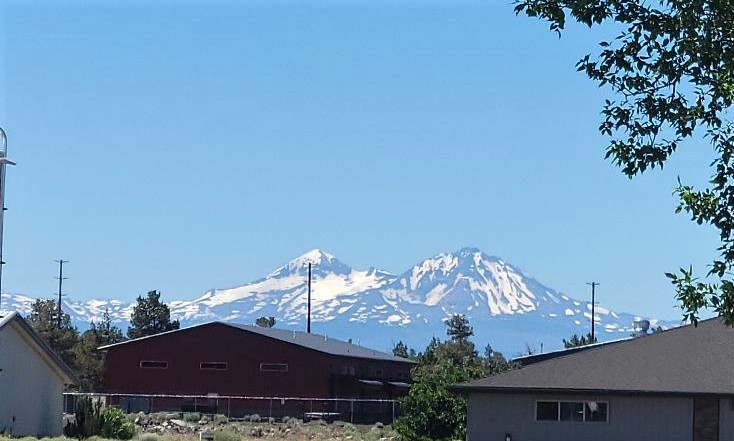
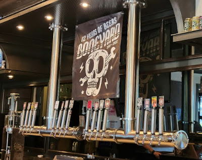
Next stop, Redmond, Oregon for some brewery and quilt shop touring.

Don’t wish upon a star – Reach for one!

Monday, July 18, 2022

Sundial Bridge and Whiskeytown

Today we did a little more exploring. One of the main attractions I found for Redding is the Sundial Pedestrian Bridge over the Sacramento River. It is definitely a work of art, and is located in a very nice park in the city.


Architect Santiago Calatrava designed the bridge. Those of you from Wisconsin may recognize that name. He also designed the art museum in Milwaukee. The museum in Milwaukee is also all white with giant "wings" that open and close twice a day. 

Calatrava described his design for the bridge as a goose in flight with the pylon representing a wing. The city, however, calls it the Sundial Bridge. They have placed blocks below it with times on them. When the shadow of the wing passes over the block, it acts like a sundial. Since it is over a river, it only shows time for four hours a day. The rest of the time the shadow is over the water. I like the goose explanation. 

Some bridge facts include it was opened on July 4, 2004 at a cost of 24 million dollars. There are 2,245 glass panels on the deck. It was kind of a weird feeling walking on the glass tiles. It weighs the same as about 400 elephants. The design was so complex it required creating new software to make the engineering calculations. 

Here's a view of the Sacramento River from the bridge.


Our second stop of the day was the Whiskeytown National Recreation Area. This is a beautiful lake in north central California and is part of the 1950s Central Valley Project; a 500 mile long water diversion system diverting water from Northern California to the Central Valley, allowing one of the world's most productive agriculture regions to thrive. A dam was created, and this lake was formed. Today it also offers all kinds of water recreation for residents including boating, fishing, beaches and camping.


The hills across the lake are covered with burned tree trunks. In 2018 there was a massive fire in the area started by a trailer tire blowing and causing sparks. 

If you enlarge the picture you can see what looks like a white rope across the lake. It's actually a curtain that goes down 100 feet. It keeps the warm water in the lake and forces the cold water flowing into the lake to the bottom which then flows back out to the Sacramento River. This is vitally important to keep the water in the river the correct temperature for Chinook Salmon to survive and lay their eggs. How amazing is that!

Down the road a few miles is a memorial to John F. Kennedy.


On September 28, 1963, less than two months before his assassination, Kennedy made his last official trip to California to dedicate the Whiskeytown Dam. The dedication completed the Central Valley Project.

Near the dam is the Glory Hole. It got that name because it looks like a Morning Glory flower.


It's a huge cement funnel that extends down 260 feet to catch overflow water and prevent flooding. We chatted with a man from the area, and he told us about the devastating fire in 2018, and how he wished water was running into the hole because the area really needs water.

There are some hiking trails in the area, but with the temperature reaching a high of 106 today, we just weren't in the mood for a hike. It is a pretty drive around the lake.

Tomorrow we head to Crater Lake National Park in Oregon. It seems we'll be staying in an area with little to no cell service or internet. Time to relax off the grid for a few days.

Don’t wish upon a star – Reach for one!

Sunday, July 17, 2022

Lassen Volcanic National Park

 Lassen Volcanic National Park was founded in 1916. It is named after Peter Lassen, one of the first white settlers in the northern Sacramento Valley who discovered a route through the mountains called Lassen Trail. The Maudi Native Americans called it Kohm Yah-mah-nee which means snow mountain.

The significance of this park is that Lassen Peak, one of the largest plug dome volcanoes in the world, had some major eruptions in 1915. Also, all four types of volcanoes can be found in the park.

The main road through the park is a two lane, winding road opened in 1931. It is 30 miles of a beautiful journey through pine forests and breathtaking views of volcano peaks.  We entered at the north entrance. Our first stop was the museum where we watched a very interesting and information movie about the park. We got some tips from a very nice ranger, and off we drove.

Our first stop was the Chaos Crags and Jumbles Overlook. A rock avalanche broke off from the Chaos Crags volcanos 350 years ago and roared down the sides for four miles.


There are a couple of campgrounds in the park. One of them for tents was along Summit Lake. Such a beautiful, peaceful location. 


Next up was the Hot Rock. On May 19, 1915 Lassen volcano erupted causing an avalanche of snow, lava and rock to come careening down its sides. This humungous rock was found five miles down. When it was discovered 40 hours after being ejected from the volcano's crater, it was still sizzling hot. 


At the Devastated Area there is a 1/2 mile loop trail explaining about the 1915 eruptions and the geology of the rocks. All the rocks in this park are from volcanoes. 

This sign shows pictures from 1910 and 1915 showing how much of the forest was destroyed from the eruptions. Click on any of the pictures to enlarge.


On May 22, 1915 the volcano erupted again with an even bigger explosion. Ash and gas blew 30,000 feet up into the air, and could be seen from 150 miles away. Today, many airplanes fly around 30,000 feet. That's just mindboggling. 


And, here is Lassen Peak in all it's glory. We were at about 8,500 feet elevation at this point. There was still snow on the ground in spots. We saw several people enjoying themselves playing in the snow.


There is a trail you can climb to the summit. It is about 5 miles round trip and about 2,000 feet in elevation gain. Not for us. There were lots of cars in the parking lot. I wonder how far they got?? At the bottom right of the picture you can see some people on the lower portion of the trail.


This volcano is called Brokeoff Mountain. It is an example of a composite volcano. There are four types of volcanoes, all of which are in this park. Lassen Peak is a plug dome. The other two types are shield and cinder cone. Those two are in the more remote areas of the park, so we didn't see them.


Near the south entrance of the park is the Sulphur Works. This is a hydrothermal area with hot springs and mud pots. These features are evidence of active volcanism and indicate the potential for future eruptions. The smell of rotten eggs caused by the Sulphur was really strong!! Too bad I don't have smellavision. You could have shared in the experience :)


This one was really bubbling. Shooting mud over a foot in the air.


We are staying at Redding RV Park in Redding, California. On our way here yesterday, we got our first glimpse of Mount Shasta which is over 14,000 feet tall. When we leave on Tuesday, we will be driving north, so I'm hoping to get even better views.


We also saw lots of orchards during our travels the last few days through Central California. The gentleman who checked us in at our campground told us they were mainly almonds, but also pistachios and olive groves. He told how as a kid he would stuff his pockets with almonds on the way to school. How awesome!

Don’t wish upon a star – Reach for one!